Matla Fm
Type Locality and Naming
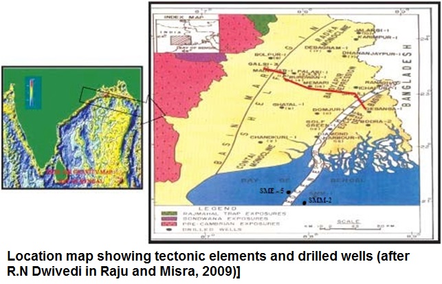
Type section is in the well Port Canning-1. [Original Publication: Chandra, M., Mallik, S., Das, D., Thakur, R.K. and Sinha, M.K. (1993) Lithostratigraphy of Petroliferous Basins, Document IX, West Bengal Basin, KDMIPE ONGC Publication, pp 1-216]
[Figure 1: Location map showing tectonic elements and drilled wells (after R.N Dwivedi in Raju and Misra, 2009)]
Lithology and Thickness
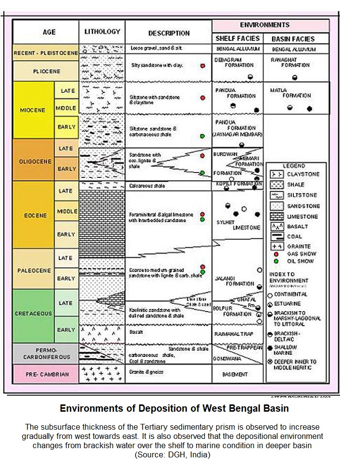
Claystone. This unit is represented by dark grey, grey, fissile shale or clay, occasionally glauconitic. Sand bands, wherever present, are very thin. Its thickness is 1500 m. in 1 Chapur-1 and 4000 m in SMM-2 and Raghunod wells.
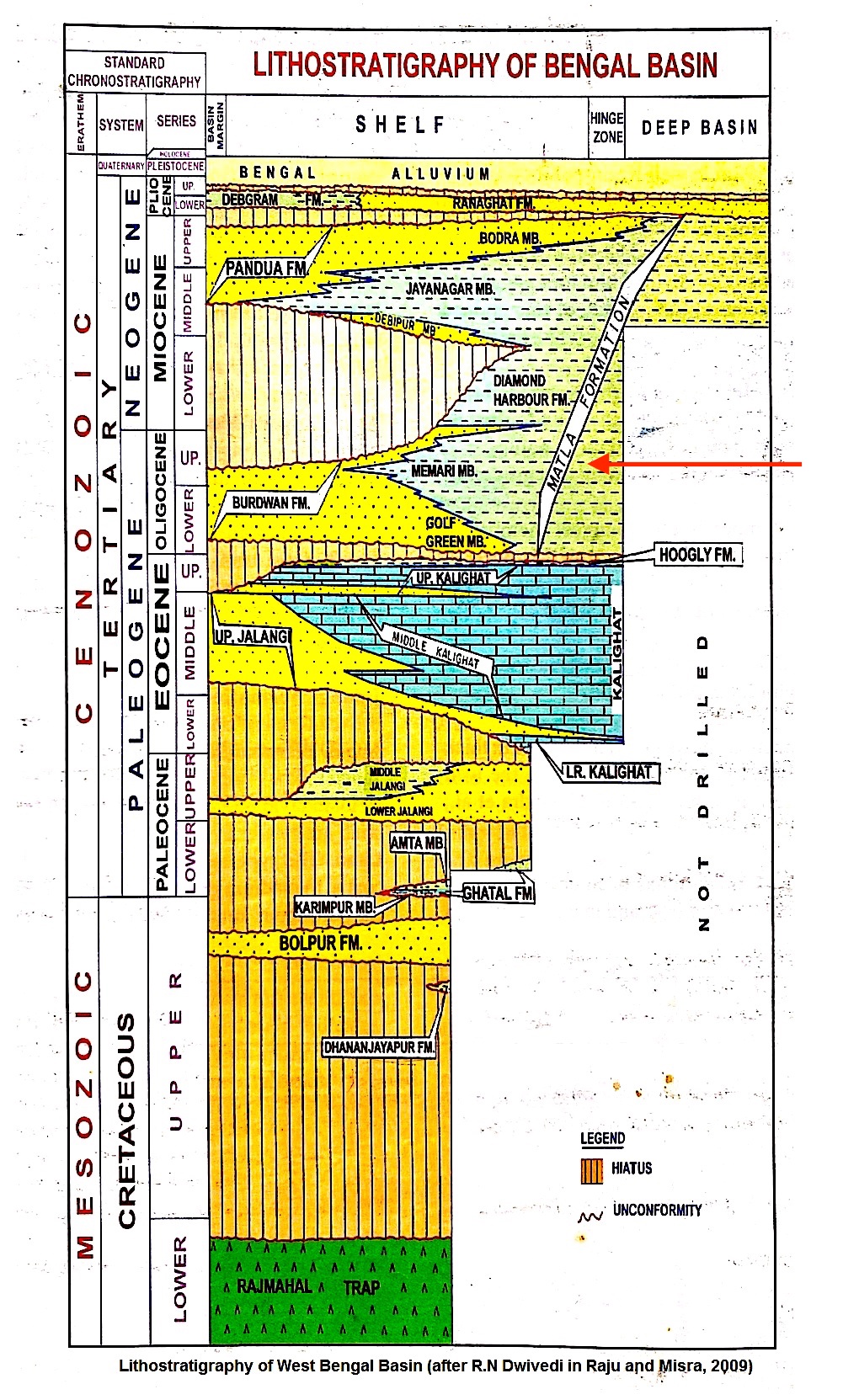
[Figure 1: West Bengal Basin lithostratigraphy (after R.N. Dwivedi in Raju and Misra, 2009) with red-arrow showing position of this formation]
Relationships and Distribution
Lower contact
Lower boundary is conformable with the Diamond Harbor Fm, Burdwan Fm and Sylhet Fm.
Upper contact
Upper boundary is conformable with the Ranaghat Fm or the Debagram Fm and unconformable with Bengal Alluvium Fm.
Regional extent
GeoJSON
Fossils
The Malta Formation is highly fossiliferous and comprises of forms represented in the Hooghly Fm, Burdwan Fm, Diamond Harbour Fm and Pandua Fm.
Age
Depositional setting
Marine environment
[Figure: Environments of Deposition of West Bengal Basin (from dghindia.gov.in)]
Additional Information


